
National Weather Service monitors
two low-water crossings in county
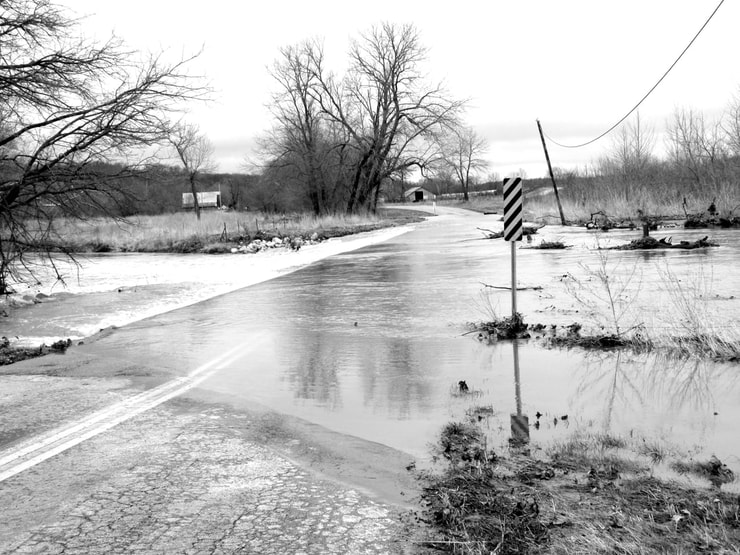
The low-water crossing at the east end of State Highway U, shown above, is one of two crossings in Barry County being monitored by the National Weather Service in Springfield.
Marc 24, 2021
Sheila Harris
According to meteorologist Doug Cramer, of the National Weather Service in Springfield, his office is monitoring 18 low-water crossings located on state highways in the service’s southwest Missouri region.
Two of those crossings are located in Barry County: one at the end of U Highway, east of Butterfield, and the second one on State Highway C at McDowell.
“The goal of the testing,” Cramer said, “is to save lives.
“Our region sees a lot of flooding. A lot of people also drown when their cars are swept away by flood waters at these crossings,” he continued.
“We are monitoring the two crossings in Barry County,” he said, “trying to get a good idea of the amount of rain it takes for the crossings to become impassable.”
According to Cramer, the weather service began monitoring the 18 low-water crossings in January and will continue to do so indefinitely. They are working closely with the Missouri Department of Transportation and the National Water Center to gather data with the goal of being able to provide earlier warnings to residents where flooding is common.
The National Water Center (NWC), a facility completed in 2015, is located on the campus of the University of Alabama. The center enables NOAA (National Atmospheric and Atmospheric Administration), in partnership with other federal agencies, to deliver a new generation of water information and services to the nation. These services, according to the water center’s website, is strengthening the nation’s water forecast capabilities for floods and droughts, improveing preparedness for water-related disasters, and informing high-value water decisions at the local, state, and national levels. By complementing existing regional River Forecast Centers with a national center, the National Weather Service (NWS) water mission area mirrors the highly successful structure of the meteorological side of the NWS.
“We are gathering data and learning some things,” Cramer said, “but we’re not yet prepared to share what we’re learning.”