
Barry County E9-1-1 continues Geographic Info System mapping for safer citizens
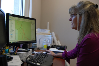 Ann Hennigan makes updates to the GIS maps at the Barry County E9-1-1 Center.
July 1, 2015
Charlea Mills
When most people think about the Barry County E9-1-1 Center, emergency dispatching comes to mind. However, the local center is much more than meets the eye, and it is much more than dispatching that keeps Barry County citizens and tourists travelling through safe in the event of an emergency.
When E9-1-1 first came to be, a company based out of Virginia was contracted to begin initial mapping process and address notification changes of the county. Instead of Rural Routes, Barry County was converted to a Farm Road system that allows emergency dispatchers to pinpoint addresses better.
Mike Phillips, the current director for Barry County E9-1-1, was the first person hired to work on a mapping system as an employee for the center. Phillips began working on the Geographic Information System (GIS), which serves to map the entire county with addresses, landmarks and geographic features to make dispatching faster, more effective and keep citizens safer.
In April, Ann Hennigan, former office manager, moved to the GIS position and is working to make the mapping system locally even more precise and detailed.
Hennigan said, “Basically, GIS is made up of three parts: the database, the map and tools.” The database keeps specific information about anything on a map, such as a specific address, landmark or town border. The map shows everything in the database in relation to the earth’s surface, and the tools are what Ann uses to create and edit the existing database and map.
Recently, Hennigan has been working with Kerry Hays, the natural resource manager at Roaring River State Park, to make sure that all locations at the park match up to a number in GIS for effective dispatching. Each building and campground at the park just finished being mapped and assigned numbers. Up next will be the hiking trails not only in the park, but also throughout the county.
Hennigan said, “It’ll really help tourists if they don’t know a physical address for where they are, but it’ll also help us to dispatch our emergency responders to the correct place.”
As far as mapping the trails, Hennigan said, “A lot of people twist their ankles when they’re out and about, not just in the park, but on all of the trails in Barry County, and we want to be able to find them, too.”
Hennigan’s job means spending three days a week out of the office, driving around with a tablet and pinpointing addresses, which is a very detailed system in the county. When the E9-1-1 Center was established, the address switch meant a detailed system to help make addresses more uniform.
The addressing system in the county is known as the Mile Marker System. The system assigns a number based on the number of miles that particular point lies from the northern and western county lines. For example, if you live at 15747 Farm Road 1240, you are approximately 24 miles east of the western county line and 15.747 miles south of the north county line. While it seems complicated, it is a simple system to establish addresses that are seamless for mapping purposes.
Hennigan said that Stewart Lombard, who did GIS after Phillips, was responsible for accurate addressing in Wheaton, Washburn, Exeter and Butterfield. She added, “He also reached out to Google because the addresses for Barry County are often wrong. He sent all of that data to them and hopefully we’ll have addressing correct. They don’t have access to names, it is just the addresses. We don’t give away any information like names or personal information away.”
E9-1-1 is very secure about personal information stored for emergency purposes. It isn’t shared with outside parties. Those who have access to the maps are the four dispatch stations, some Emergency Medical Services and some law enforcement and fire departments. Hennigan said, “If they have a laptop, we can load a map onto it. They can’t make changes, but they can find where they are going a lot faster.”
Hennigan said, “It’s a big county. It’s a lot of miles to cover. They’re all over, so you spend a lot of time driving to cover all of theses places, but it’s all worth it because everyone deserves to be found in the case of an emergency.”
In the bigger picture, Hennigan also plans to label the type of road (i.e. gravel, chip and seal, asphalt, etc.) and sources of water. Hennigan said, “If there is any type of incident, we want to know what road is going to be faster. Obviously a chip and seal road is going to be faster than a gravel road.” She said mapping the water sources will be useful for if a fire department needs to refill their tanker when working a fire.
Hennigan said, “What we’re doing now is just the tip of the iceberg.”